 vesseltracker.com
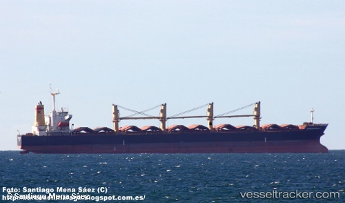
Vessel BRIGHT WORLD IMO: 9181041, MMSI: 355300000
UTC, 24.54235, 56.79164, course: 78, speed: 0.1
UTC, 24.54234, 56.79157, course: 71, speed: 0.1
2026-01-31 17:10:02 UTC, 24.54238, 56.79191, course: 19, speed: 0.1
Live AIS position:
UTC. 21 nm SE of Shinas),
updated 2026-01-31 17:10:02 UTC.
Find the position of the vessel BRIGHT WORLD on the map. The latter are known coordinates and path.
marine traffic ship tracker show on live map
The current position of vessel BRIGHT WORLD is 24.54238 lat / 56.79191 lng. Updated: 2026-01-31 17:10:02 UTCDetails:
Last coordinates of the vessel:
UTC, 24.54228, 56.79175, course: 85, speed: 0.1UTC, 24.54235, 56.79164, course: 78, speed: 0.1
UTC, 24.54234, 56.79157, course: 71, speed: 0.1
2026-01-31 17:10:02 UTC, 24.54238, 56.79191, course: 19, speed: 0.1